Hello Wayfinder! 👋
Wayfinder is an indoor navigation app allowing mobile devices to find the shortest route through a building. The app is developed by Bouvet and uses Azure Spatial Anchors and Augmented Reality. Below you can see how we implemented this in our office in Stavanger.

We have developed a product which enables the end user to navigate between two anchor points. We call this product Wayfinder. The anchors consist of Azure Spatial Anchors (ASA), and are saved in Azure. These can be created by scanning an area with a camera (e.g., phone camera) and then save the scanned data in the cloud. The anchors are saved with relations to each other, meaning when the end user is nearby one of the anchors, the information about where the other anchors are is available. This is also true for anchors that could be on the other side of the building.
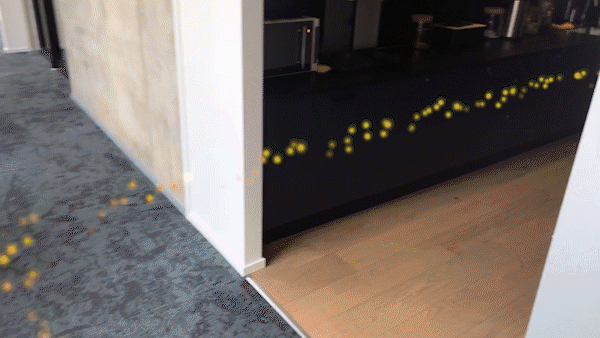
Our algorithm finds the shortest route through all of the anchors from the start point to the destination. For the end user it would look like in the gif seen below.
In practice the app has two parts; edit mode and navigation mode.
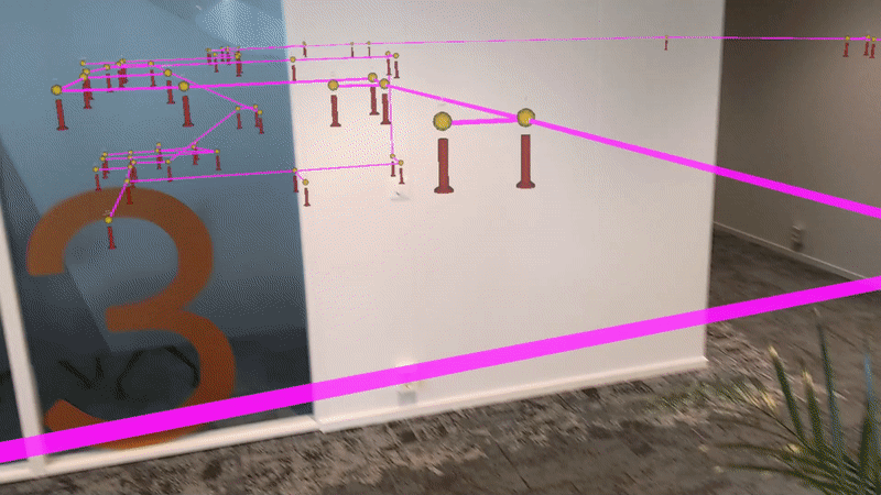
The edit mode is only available for an admin user of Wayfinder. In this mode Spatial Anchors can be created, deleted, in addition to setting up connections between them. The anchors are placed at tactical areas of the building, such as crossways, hallways, stairways and doorways. It is also possible to name anchors which will act as a start point or destination.
When all the anchors have been placed, and all the connections between them have been created, navigation mode is ready to be used. The end user selects where they are, and where they are going from a list of all named anchors. Wayfinder will then recognize the end user’s physical location in the building through the device’s camera. The shortest route is then calculated and has a computational time between 2 and 30 milliseconds. When the pathfinding algorithm is finished calculating, the result will be shown to the user as a sparkling golden trail towards their destination.